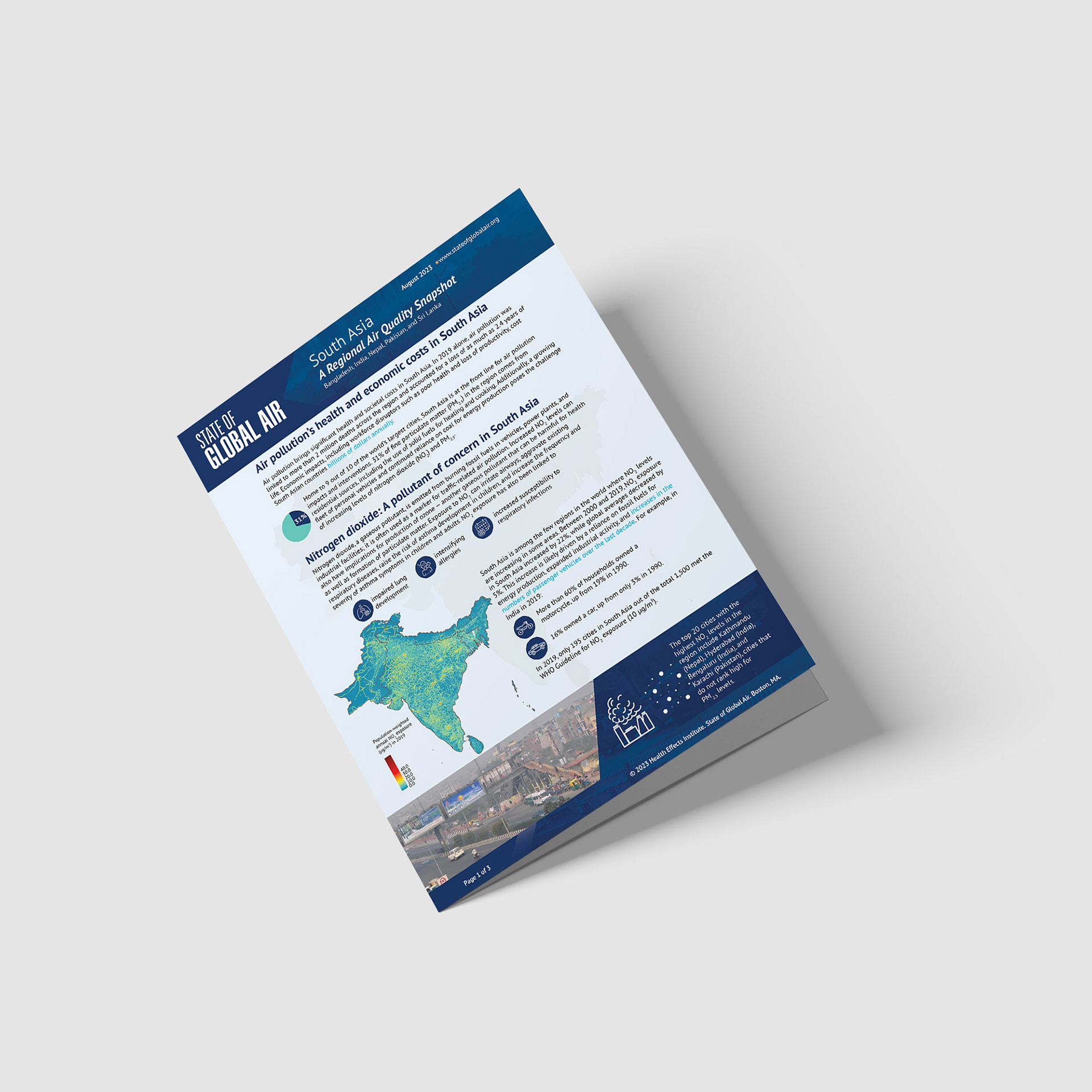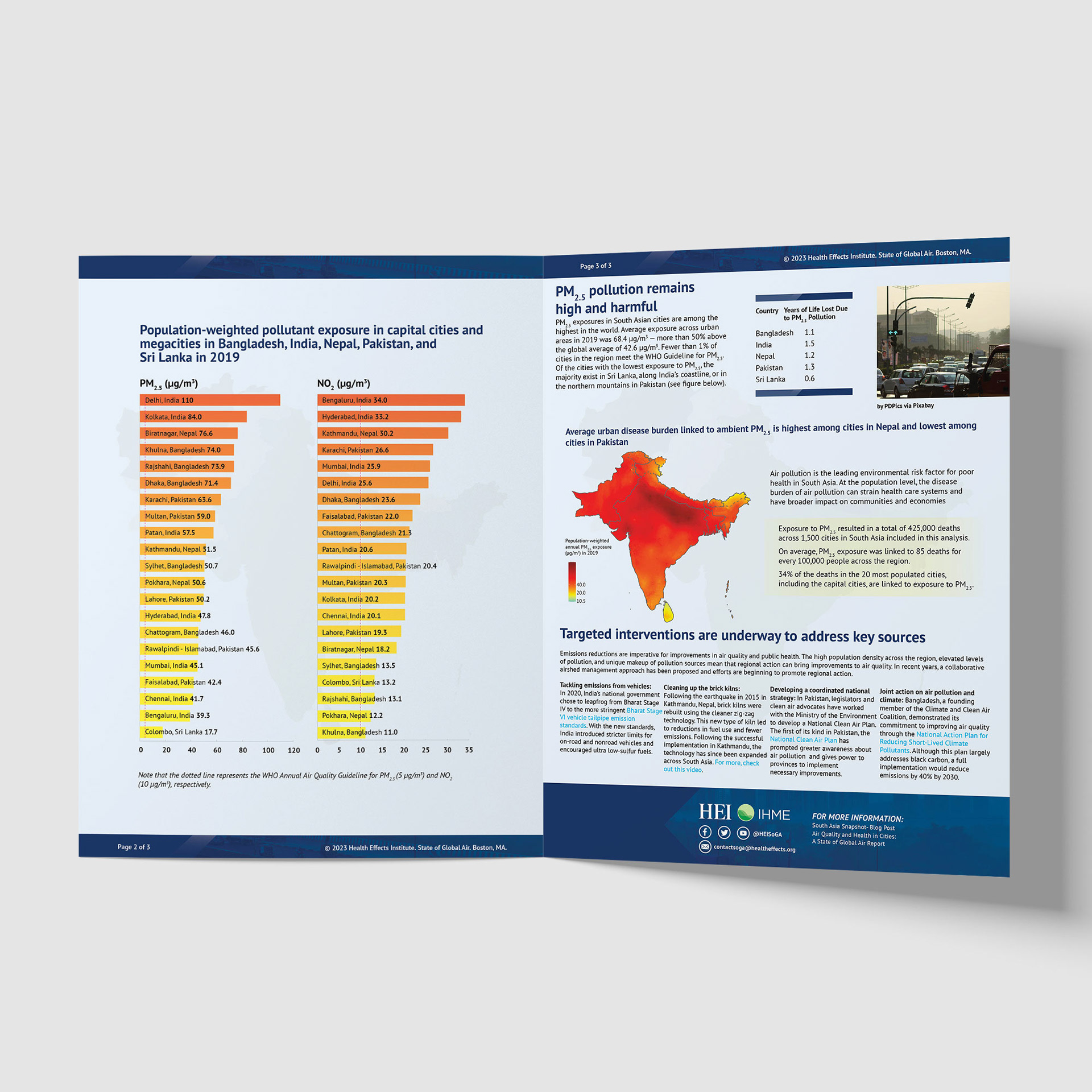
This project involved the design of a regional air quality snapshot developed for the Health Effects Institute (HEI), focusing on urban air pollution and health risks across South Asia. The publication draws from global analyses of air quality trends and highlights regional exposure to pollutants such as fine particulate matter (PM2.5) and nitrogen dioxide (NO2), particularly within rapidly urbanizing cities and megacities.
The snapshot addresses the scale and complexity of air pollution in South Asia, where population growth, energy production, transportation, industry, agricultural burning, and transboundary pollution intersect. While PM2.5 has often dominated air quality discussions, the data presented in this publication supports the need for a more comprehensive air pollution management approach at local, national, and regional levels.
For this project, HEI provided base map assets, which I refined, enhanced, and integrated into a cohesive visual system. Using a combination of Adobe Photoshop and Adobe InDesign, I unified vector-based elements, high-quality imagery, and data visualizations into a disciplined infographic layout. Particular attention was given to consistency, legibility, and hierarchy to ensure the information remained accessible while maintaining scientific credibility.
The final publication functions as a focused, region-specific communication tool, supporting policy discussion, research dissemination, and public understanding of air quality challenges in South Asia.
Tools: Adobe InDesign, Adobe Photoshop
Deliverable: Regional snapshot infographic publication
Focus: Data-driven design, environmental health communication, infographic layout
Deliverable: Regional snapshot infographic publication
Focus: Data-driven design, environmental health communication, infographic layout